
Berlin: Difference between revisions
Replaced content with "It's hitler Duck my sick dude I rock" Tags: Replaced Reverted blanking Mobile edit Mobile web edit |
Reverting edit(s) by 2600:387:4:803:0:0:0:68 (talk) to rev. 7832055 by ChenzwBot: Vandalism (RW 16) Tag: Undo |
||
| Line 1: | Line 1: | ||
{{Use dmy dates|date=September 2020}} |
|||
It's [[hitler]] |
|||
{{Infobox settlement |
|||
Duck my sick dude I rock |
|||
| name = Berlin |
|||
| subdivision_type = [[List of sovereign states|Country]] |
|||
| subdivision_name = {{Flag|Germany}} |
|||
| subdivision_type1 = [[States of Germany|State]] |
|||
| subdivision_name1 = |
|||
Berlin |
|||
| settlement_type = |
|||
[[Capital city]], [[States of Germany|state]] and [[Municipalities of Germany|municipality]] |
|||
| image_skyline = {{Photomontage|position=center |
|||
| photo1a = Reichstag Berlin Germany.jpg |
|||
| photo2a = Brandenburger Tor abends.jpg |
|||
| photo2b = Berliner Dom, Westfassade, Nacht, 160309, ako.jpg |
|||
| photo3a = Schloss Charlottenburg zur blauen Stunde.jpg |
|||
| photo3b = Berlin-035 (cropped).jpg |
|||
| photo4a = Siegessäule-Berlin-Tiergarten.jpg |
|||
| photo4b = Hochhäuser am Potsdamer Platz, Berlin, 160606, ako.jpg |
|||
| photo5a = Panorama Gendarmenmarkt-Berlin-Huntke-2008.jpg |
|||
| color_border = white |
|||
| color = white |
|||
| spacing = 2 |
|||
| size = 270 |
|||
| foot_montage = From top, left to right: [[Reichstag building|Reichstag]]; [[Brandenburg Gate]]; [[Berlin Cathedral]]; [[Charlottenburg Palace]]; [[Museum Island]] and [[Fernsehturm Berlin]]; [[Berlin Victory Column|Victory Column]]; [[Potsdam Square]]; [[Gendarmenmarkt]] |
|||
}} |
|||
| image_shield = Coat of arms of Berlin.svg |
|||
| shield_size = 70px |
|||
| pushpin_map = Germany#Europe |
|||
| pushpin_relief = yes |
|||
| pushpin_map_caption = Location within [[Germany]] |
|||
| coordinates = {{coord|52|31|12|N|13|24|18|E|format=dms|display=inline,title}} |
|||
| image_flag = Flag_of_Berlin.svg |
|||
| image_map = {{maplink|frame=y|plain=yes|frame-align=center|type=shape<!--line-->|fill=#ffffff|fill-opacity=0|stroke-color=|stroke-width=2|frame-width=250|frame-height=300}} |
|||
| total_type = City/State |
|||
| area_total_km2 = 891.7 |
|||
| area_footnotes = <ref name="statoffice">{{cite web |access-date=2 May 2019 |title = Amt für Statistik Berlin Brandenburg – Statistiken |url = https://www.statistik-berlin-brandenburg.de/Statistiken/inhalt-statistiken.asp |website=[[Amt für Statistik Berlin-Brandenburg]] |language = de}}</ref> |
|||
| population_total = 3769495 |
|||
| population_footnotes = <ref name="pop-detail">{{cite web|url=https://www.statistik-berlin-brandenburg.de/publikationen/stat_berichte/2020/SB_A01-05-00_2019h02_BE.pdf|title=Statistischer Bericht: Einwohnerinnen und Einwohner im Land Berlin am 31. Dezember 2019|trans-title=Statistical Report: Residents in the state of Berlin on 31 December 2019 |pages=4, 10, 13, 18–22 |website=[[Amt für Statistik Berlin-Brandenburg]]|access-date=8 April 2020|language=de}}</ref> |
|||
| population_as_of = 31 December 2019 |
|||
| population_urban = 4473101 |
|||
| population_urban_footnotes = <ref name="citypopulation_urban">{{cite web|url=http://citypopulation.de/en/germany/urbanareas/|author=citypopulation.de quoting Federal Statistics Office|title=Germany: Urban Areas|access-date=2021-01-28|archive-url=https://web.archive.org/web/20200603133151/http://citypopulation.de/en/germany/urbanareas/|archive-date=2020-06-03|url-status=live}}</ref> |
|||
| population_metro = 6144600 |
|||
| population_metro_footnotes = <ref>{{cite web |url=https://www.statistik-berlin-brandenburg.de/pms/2019/19-02-08.pdf |title=Bevölkerungsanstieg in Berlin und Brandenburg mit nachlassender Dynamik |date=8 February 2019 |website=statistik-berlin-brandenburg.de |publisher=Amt für Statistik Berlin-Brandenburg |access-date=24 November 2019}}{{Dead link|date=July 2020 |bot=InternetArchiveBot |fix-attempted=yes}}</ref> |
|||
| elevation_m = 34 |
|||
| population_demonyms = Berliner(s) (English)<br/>Berliner (m), Berlinerin (f) (German) |
|||
| blank_name_sec1 = [[Gross regional product|GRP (nominal)]] |
|||
| blank_info_sec1 = €155 billion (2020)<ref>{{cite web |url = https://www.statistikportal.de/en/node/649 |title = Bruttoinlandsprodukt – in jeweiligen Preisen – 1991 bis 2020|website = www.statistikportal.de}}</ref> |
|||
| blank1_name_sec1 = GRP per capita |
|||
| blank1_info_sec1 = €41,000 (2020) |
|||
| blank2_name_sec2 = [[Human Development Index|HDI]] (2018) |
|||
| blank2_info_sec2 = 0.950<ref name="GlobalDataLab">{{Cite web|url=https://hdi.globaldatalab.org/areadata/shdi/|title=Sub-national HDI – Area Database – Global Data Lab|website=hdi.globaldatalab.org|language=en|access-date=13 September 2018}}</ref><br/>{{color|green|very high}} · [[List of German states by Human Development Index|4th of 16]] |
|||
| timezone1 = [[Central European Time|CET]] |
|||
| utc_offset1 = +01:00 |
|||
| timezone1_DST = [[Central European Summer Time|CEST]] |
|||
| utc_offset1_DST = +02:00 |
|||
| blank_name_sec2 = [[GeoTLD]] |
|||
| blank_info_sec2 = [[.berlin]] |
|||
| website = {{URL|www.berlin.de/en/}} |
|||
| governing_body = [[Abgeordnetenhaus of Berlin]] |
|||
| leader_title = [[Governing Mayor of Berlin|Governing Mayor]] |
|||
| leader_name = [[Michael Müller (politician, born 1964)|Michael Müller]] |
|||
| leader_party = [[Social Democratic Party of Germany|SPD]] |
|||
<!-- not supported |
|||
|ruling_party1=[[Social Democratic Party of Germany|SPD]] |
|||
|ruling_party2=[[The Left (Germany)|Left]] |
|||
|ruling_party3=[[Alliance 90/The Greens|Greens]] |
|||
|votes=4 |
|||
-->| geocode = [[Nomenclature of Territorial Units for Statistics|NUTS Region]]: DE3 |
|||
| area_code = [[List of dialling codes in Germany#030 – Berlin|030]] |
|||
| registration_plate = B{{NoteTag |1 = Prefixes for vehicle registration were introduced in 1906, but often changed due to the political changes after 1945. Vehicles were registered under the following prefixes: "I A" (1906 – April 1945; devalidated on 11 August 1945); no prefix, only digits (from July to August 1945), "БГ" (=BG; 1945–46, for cars, trucks and busses), "ГФ" (=GF; 1945–46, for cars, trucks and busses), "БM" (=BM; 1945–47, for motor bikes), "ГM" (=GM; 1945–47, for motor bikes), "KB" (i.e.: [[Allied Kommandatura|Kommandatura]] of Berlin; for all of Berlin 1947–48, continued for [[West Berlin]] until 1956), "GB" (i.e.: Greater Berlin, for [[East Berlin]] 1948–53), "I" (for East Berlin, 1953–90), "B" (for West Berlin from 1 July 1956, continued for all of Berlin since 1990).}} |
|||
| iso_code = DE-BE |
|||
| official_name = |
|||
}} |
|||
'''Berlin''' ({{IPAc-en|b|ɜːr|ˈ|l|ɪ|n}}; {{IPA-de|bɛʁˈliːn|lang|de-Berlin.ogg}}<ref>{{cite book|title=Das Aussprachewörterbuch|last1=Kleiner|first1=Stefan|last2=Knöbl|first2=Ralf|last3=Mangold|first3=Max|publisher=Duden|year=2015|isbn=978-3-411-04067-4|edition=7th|location=Berlin|page=229}}</ref>) is the [[capital (city)|capital city]] of [[Germany]]. It is the largest [[city]] in the [[European Union]] by [[population]], with more than 3.7 million people.<ref>{{Cite web|url=https://www.statistik-berlin-brandenburg.de/BasisZeitreiheGrafik/Bas-Einwohnerregister.asp?Ptyp=300&Sageb=12041&creg=BBB&anzwer=11|title=Amt für Statistik Berlin Brandenburg - Statistiken|website=www.statistik-berlin-brandenburg.de|accessdate=2017-06-25|archive-date=2018-12-26|archive-url=https://web.archive.org/web/20181226014557/https://www.statistik-berlin-brandenburg.de/BasisZeitreiheGrafik/Bas-Einwohnerregister.asp?Ptyp=300&Sageb=12041&creg=BBB&anzwer=11%20|url-status=live}}</ref> The city is in the eastern part of Germany. It is about {{convert|70|km|mi|2|abbr=on|lk=on}} west of [[Poland]]. Berlin has an area of {{convert|891|km2|sqmi|2|abbr=on|lk=on}}. The [[river]]s [[Havel]], [[Dahme]] and [[Spree]] run through Berlin. It has an [[oceanic climate]]. |
|||
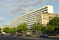
Berlin is home to many famous buildings and monuments, like the [[Siegessäule]], the [[Brandenburger Tor]], the [[Reichstag (building)|Reichstag]] and the boulevard [[Unter den Linden]]. On the boulevard are the [[Humboldt University]] and the [[State Opera of Berlin]]. The [[Governing Mayor]] of the city is [[Michael Müller]] ([[SPD]]). |
|||
Berlin is a [[Global city|world city]] of culture, politics, media and science.<ref>{{Cite web |url=http://www.mori-m-foundation.or.jp/english/research/project/6/pdf/GPCI2009_English.pdf |title=Archived copy |access-date=2017-06-25 |archive-date=2014-06-29 |archive-url=https://web.archive.org/web/20140629143736/http://www.mori-m-foundation.or.jp/english/research/project/6/pdf/GPCI2009_English.pdf |url-status=live }}</ref> There are a lot of technology companies in the city. They are important for the city's [[economy]]. Many planes and trains travel to and from Berlin because the city is an important place for tourism and business.<ref>{{Cite news|url=https://www.bloomberg.com/news/articles/2014-09-03/berlin-beats-rome-as-tourist-attraction-as-hordes-descend|title=Berlin Beats Rome as Tourist Attraction as Hordes Descend|newspaper=Bloomberg.com|access-date=2017-06-25|archive-date=2017-11-24|archive-url=https://web.archive.org/web/20171124032618/https://www.bloomberg.com/news/articles/2014-09-03/berlin-beats-rome-as-tourist-attraction-as-hordes-descend|url-status=live}}</ref> |
|||
Berlin is an important city for the history of Germany. The King of Prussia and the Emperor of Germany lived in Berlin. The government of Germany was in Berlin for many years. Bombs destroyed many buildings in the city in [[World War II|World War Two]]. The city was split into [[West Berlin]] and [[East Berlin]] after World War Two. After the [[Berlin Wall]] was built in 1961 very few people were allowed to cross from East Berlin into West Berlin. The wall divided the city until 1989 when the East German government decided to allow anyone to cross, and people decided to destroy the wall. |
|||
== Boroughs == |
|||
{{main|Boroughs of Berlin}} |
|||
[[File:Berlin.bezirke.png|thumb|right|map of the berlin boroughs]] |
|||
In 2001 the 23 boroughs of Berlin were changed into 12 |
|||
# [[Charlottenburg-Wilmersdorf]] |
|||
# [[Friedrichshain-Kreuzberg]] |
|||
# [[Lichtenberg-Hohenschönhausen]] |
|||
# [[Marzahn-Hellersdorf]] |
|||
# [[Berlin-Mitte|Mitte]] (Central) |
|||
# [[Neukölln]] |
|||
# [[Pankow]] |
|||
# [[Reinickendorf]] |
|||
# [[Spandau]] |
|||
# [[Steglitz-Zehlendorf]] |
|||
# [[Tempelhof-Schöneberg]] |
|||
# [[Treptow-Köpenick]] |
|||
== Sights == |
|||
* [[Alexanderplatz]] (with the Television Tower) |
|||
* [[Berliner Dom]] (Berlin's [[cathedral]]) |
|||
* [[Berlin Hauptbahnhof]] (the new main Railway station) |
|||
* [[Brandenburg Gate]] |
|||
* [[Fernsehturm]] (the TV tower - the highest building in Germany) |
|||
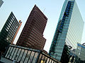
* [[Potsdamer Platz]] |
|||
* [[Reichstag (building)|Reichstag building]] (home of the [[Bundestag]]) |
|||
* [[Rotes Rathaus]] (office of the Governing Mayor) |
|||
* [[Straße des 17. Juni]] (Street of the 17th of June) |
|||
* [[Siegessäule]] (Statue of Victory) |
|||
* [[Unter den Linden]] (the main boulevard) |
|||
== History == |
|||
* [[1244]] The first writings about a place called Berlin. |
|||
* [[1451]] The [[Hohenzollern]] family moved to Berlin as the place to rule their country |
|||
* [[1618]] – 48 After the [[Thirty Years' War]] in Germany, the number of people that lived in Berlin dropped to only 6000. |
|||
* [[1701]] Berlin became capital of [[Prussia]]. |
|||
* [[1709]] Berlin and its neighbor city Cölln (not Köln/Cologne) are combined to form the new Berlin. |
|||
* [[1806]] The army of [[Napoleon Bonaparte]] moved into Berlin. |
|||
* [[1871]] Berlin became capital of the [[German Empire]]. |
|||
* [[1920]] The Old Berlin and some neighbour towns are combined into "Greater Berlin" (Groß-Berlin). |
|||
* [[1945]] The town is divided into four sectors, used by the allies of [[World War II]]. There is a [[Soviet]] Sector, an [[United States|American]] Sector, a [[British]] Sector and a [[France|French]] Sector. |
|||
* [[1949]] After foundation of the two Germanies, the town is still divided. There is now [[West Berlin]] and [[East Berlin]]. |
|||
* [[1961]] The [[Berlin Wall]] was built by the communist government of East Germany between the two halves of Berlin. |
|||
* [[1990]] After [[German reunification]], the Berlin Wall is torn down, and there is only one Berlin again. The new Berlin becomes the capital of one Germany. |
|||
== Gallery == |
|||
<gallery> |
|||
Image:Berlin Reichstag BW 2.jpg|[[Reichstag (building)|Reichstag]] |
|||
Image:Potsdamer Platz.JPG|Potsdamer Platz |
|||
Image:Brandenburgertor SN.jpg|[[Brandenburg Gate]] |
|||
Image:Berlin-Charlottenburg Theater des Westens 05-2014.jpg|The Theatre of the West |
|||
Image:Schloss Bellevue.jpg|Bellevue Palace |
|||
Image:Siegessäule 2.JPG|Victory column |
|||
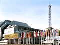
Image:ICC Funkturm Berlin.jpg|International Congress Center |
|||
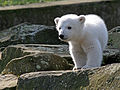
Image:Knut IMG 8095.jpg|Berlin Zoo, Polar bear cub "Knut" 24.03.2007 |
|||
Image:Buddy Bear One-World Bär.JPG|The [[:en:United Buddy Bears|Buddy Bear]] has become an unofficial ambassador for Germany and is a symbol of Berlin. |
|||
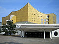
Image:Philharmonie 1a.jpg|Berlin Philharmonic |
|||
Image:Tu hauptgebaude 2006.jpg|Technical University Berlin |
|||
Image:Nefertiti 30-01-2006.jpg|Nefertiti at the Egyptian Museum |
|||
</gallery> |
|||
== Sister cities == |
|||
Berlin has partnerships with 17 cities.<ref>{{cite web|url=https://www.berlin.de/rbmskzl/en/international-relations/city-partnerships/|title=Berlin's international city relations|publisher=Der Regierende Bürgermeister von Berlin, Referat IV B|accessdate=2007-11-09|archive-date=2008-08-22|archive-url=https://web.archive.org/web/20080822100321/http://www.berlin.de/rbmskzl/staedteverbindungen/index.en.html|url-status=live}}</ref> Each of the 12 boroughs also has their sister cities, sometimes called twin cities. |
|||
{| |
|||
| valign="top" | |
|||
* {{flag|United States}}, '''[[Los Angeles]]''', (1967) |
|||
* {{flag|France}}, '''[[Paris]]''', (1987) |
|||
* {{flag|Spain}}, '''[[Madrid]]''', (1988) |
|||
* {{flag|Turkey}}, '''[[Istanbul]]''', (1989) |
|||
* {{flag|Russia}}, '''[[Moscow]]''', (1990) |
|||
| valign="top" | |
|||
* {{flag|Poland}}, '''[[Warsaw]]''', (1991) |
|||
* {{flag|Hungary}}, '''[[Budapest]]''', (1991) |
|||
* {{flag|Belgium}}, '''[[Brussels]]''', (1992) |
|||
* {{flag|Indonesia}}, '''[[Jakarta]]''', (1993) |
|||
* {{flag|Uzbekistan}}, '''[[Tashkent]]''', (1993) |
|||
* {{flag|Mexico}}, '''[[Mexico City]]''', (1993) |
|||
| valign="top" | |
|||
* {{flag|China}}, '''[[Beijing]]''', (1994) |
|||
* {{flag|Japan}}, '''[[Tokyo]]''', [[Japan]], (1994) |
|||
* {{flag|Argentina}}, '''[[Buenos Aires]]''', (1994) |
|||
* {{flag|Czech Republic}}, '''[[Prague]]''', (1995) |
|||
* {{flag|Namibia}}, '''[[Windhoek]]''', (2000) |
|||
* {{flag|United Kingdom}}, '''[[London]]''', (October 2000) |
|||
|} |
|||
==Notes== |
|||
{{reflist|group=note}} |
|||
== References == |
|||
{{reflist}} |
|||
== Other websites == |
|||
{{Commonscat}} |
|||
* [http://www.berlin.de - German page www.berlin.de] |
|||
* [http://www.berlin-sightseeing-tours.de Berlin Sightseeing Tours] |
|||
* [http://www.digitalberlin.com digital Berlin] |
|||
* [http://www.exberliner.com EXBERLINER - English City Magazine] |
|||
* [http://www.panorama-cities.net/berlin/berlin_germany.html Berlin City Panoramas] - Panoramic Views and virtual Tours of Berlin |
|||
* [http://wiki.worldflicks.org/berlin.html WorldFlicks in Berlin: Photos and interesting places on Google Maps] {{Webarchive|url=https://web.archive.org/web/20091025143045/http://wiki.worldflicks.org/berlin.html |date=2009-10-25 }} |
|||
{{European capitals}} |
|||
{{Cities in Germany}} |
|||
{{States of Germany}} |
|||
{{Boroughs of Berlin}} |
|||
{{Hanseatic League}} |
|||
{{authority control}} |
|||
[[Category:Berlin| ]] |
|||
[[Category:Olympic cities]] |
|||
Revision as of 02:30, 20 October 2021
Berlin | |
|---|---|
    .jpg)    From top, left to right: Reichstag; Brandenburg Gate; Berlin Cathedral; Charlottenburg Palace; Museum Island and Fernsehturm Berlin; Victory Column; Potsdam Square; Gendarmenmarkt | |
 Coat of arms | |
 | |
 Berlin Location within Germany  Berlin Berlin (Europe) | |
| Coordinates: 52°31′12″N 13°24′18″E / 52.52000°N 13.40500°E | |
| Country | |
| State | Berlin |
| Government | |
| • Body | Abgeordnetenhaus of Berlin |
| • Governing Mayor | Michael Müller (SPD) |
| Area | |
| • City/State | 891.7 km2 (344.3 sq mi) |
| Elevation | 34 m (112 ft) |
| Population (31 December 2019)[2] | |
| • City/State | 3,769,495 |
| • Urban | 4,473,101 |
| • Metro | 6,144,600 |
| Demonyms | Berliner(s) (English) Berliner (m), Berlinerin (f) (German) |
| Time zone | UTC+01:00 (CET) |
| • Summer (DST) | UTC+02:00 (CEST) |
| Area codes | 030 |
| Geocode | NUTS Region: DE3 |
| ISO 3166 code | DE-BE |
| Vehicle registration | B[note 1] |
| GRP (nominal) | €155 billion (2020)[5] |
| GRP per capita | €41,000 (2020) |
| GeoTLD | .berlin |
| HDI (2018) | 0.950[6] very high · 4th of 16 |
| Website | www |

Berlin (/bɜːrˈlɪn/; German: [bɛʁˈliːn] (![]() listen)[7]) is the capital city of Germany. It is the largest city in the European Union by population, with more than 3.7 million people.[8] The city is in the eastern part of Germany. It is about 70 km (43.50 mi) west of Poland. Berlin has an area of 891 km2 (344.02 sq mi). The rivers Havel, Dahme and Spree run through Berlin. It has an oceanic climate.
listen)[7]) is the capital city of Germany. It is the largest city in the European Union by population, with more than 3.7 million people.[8] The city is in the eastern part of Germany. It is about 70 km (43.50 mi) west of Poland. Berlin has an area of 891 km2 (344.02 sq mi). The rivers Havel, Dahme and Spree run through Berlin. It has an oceanic climate.
Berlin is home to many famous buildings and monuments, like the Siegessäule, the Brandenburger Tor, the Reichstag and the boulevard Unter den Linden. On the boulevard are the Humboldt University and the State Opera of Berlin. The Governing Mayor of the city is Michael Müller (SPD).
Berlin is a world city of culture, politics, media and science.[9] There are a lot of technology companies in the city. They are important for the city's economy. Many planes and trains travel to and from Berlin because the city is an important place for tourism and business.[10]
Berlin is an important city for the history of Germany. The King of Prussia and the Emperor of Germany lived in Berlin. The government of Germany was in Berlin for many years. Bombs destroyed many buildings in the city in World War Two. The city was split into West Berlin and East Berlin after World War Two. After the Berlin Wall was built in 1961 very few people were allowed to cross from East Berlin into West Berlin. The wall divided the city until 1989 when the East German government decided to allow anyone to cross, and people decided to destroy the wall.
Boroughs

In 2001 the 23 boroughs of Berlin were changed into 12
- Charlottenburg-Wilmersdorf
- Friedrichshain-Kreuzberg
- Lichtenberg-Hohenschönhausen
- Marzahn-Hellersdorf
- Mitte (Central)
- Neukölln
- Pankow
- Reinickendorf
- Spandau
- Steglitz-Zehlendorf
- Tempelhof-Schöneberg
- Treptow-Köpenick
Sights
- Alexanderplatz (with the Television Tower)
- Berliner Dom (Berlin's cathedral)
- Berlin Hauptbahnhof (the new main Railway station)
- Brandenburg Gate
- Fernsehturm (the TV tower - the highest building in Germany)
- Potsdamer Platz
- Reichstag building (home of the Bundestag)
- Rotes Rathaus (office of the Governing Mayor)
- Straße des 17. Juni (Street of the 17th of June)
- Siegessäule (Statue of Victory)
- Unter den Linden (the main boulevard)
History
- 1244 The first writings about a place called Berlin.
- 1451 The Hohenzollern family moved to Berlin as the place to rule their country
- 1618 – 48 After the Thirty Years' War in Germany, the number of people that lived in Berlin dropped to only 6000.
- 1701 Berlin became capital of Prussia.
- 1709 Berlin and its neighbor city Cölln (not Köln/Cologne) are combined to form the new Berlin.
- 1806 The army of Napoleon Bonaparte moved into Berlin.
- 1871 Berlin became capital of the German Empire.
- 1920 The Old Berlin and some neighbour towns are combined into "Greater Berlin" (Groß-Berlin).
- 1945 The town is divided into four sectors, used by the allies of World War II. There is a Soviet Sector, an American Sector, a British Sector and a French Sector.
- 1949 After foundation of the two Germanies, the town is still divided. There is now West Berlin and East Berlin.
- 1961 The Berlin Wall was built by the communist government of East Germany between the two halves of Berlin.
- 1990 After German reunification, the Berlin Wall is torn down, and there is only one Berlin again. The new Berlin becomes the capital of one Germany.
Gallery
-

-
 Potsdamer Platz
 -

-
 The Theatre of the West
 -
 Bellevue Palace
 -
 Victory column
 -
 International Congress Center
 -
 Berlin Zoo, Polar bear cub "Knut" 24.03.2007
 -
 The Buddy Bear has become an unofficial ambassador for Germany and is a symbol of Berlin.
 -
 Berlin Philharmonic
 -
 Technical University Berlin
 -
 Nefertiti at the Egyptian Museum


Sister cities
Berlin has partnerships with 17 cities.[11] Each of the 12 boroughs also has their sister cities, sometimes called twin cities.
|
|
Notes
- ↑ Prefixes for vehicle registration were introduced in 1906, but often changed due to the political changes after 1945. Vehicles were registered under the following prefixes: "I A" (1906 – April 1945; devalidated on 11 August 1945); no prefix, only digits (from July to August 1945), "БГ" (=BG; 1945–46, for cars, trucks and busses), "ГФ" (=GF; 1945–46, for cars, trucks and busses), "БM" (=BM; 1945–47, for motor bikes), "ГM" (=GM; 1945–47, for motor bikes), "KB" (i.e.: Kommandatura of Berlin; for all of Berlin 1947–48, continued for West Berlin until 1956), "GB" (i.e.: Greater Berlin, for East Berlin 1948–53), "I" (for East Berlin, 1953–90), "B" (for West Berlin from 1 July 1956, continued for all of Berlin since 1990).
References
- ↑ "Amt für Statistik Berlin Brandenburg – Statistiken". Amt für Statistik Berlin-Brandenburg (in German). Retrieved 2 May 2019.
- ↑ "Statistischer Bericht: Einwohnerinnen und Einwohner im Land Berlin am 31. Dezember 2019" [Statistical Report: Residents in the state of Berlin on 31 December 2019] (PDF). Amt für Statistik Berlin-Brandenburg (in German). pp. 4, 10, 13, 18–22. Retrieved 8 April 2020.
- ↑ citypopulation.de quoting Federal Statistics Office. "Germany: Urban Areas". Archived from the original on 3 June 2020. Retrieved 28 January 2021.
- ↑ "Bevölkerungsanstieg in Berlin und Brandenburg mit nachlassender Dynamik" (PDF). statistik-berlin-brandenburg.de. Amt für Statistik Berlin-Brandenburg. 8 February 2019. Retrieved 24 November 2019.[permanent dead link]
- ↑ "Bruttoinlandsprodukt – in jeweiligen Preisen – 1991 bis 2020". www.statistikportal.de.
- ↑ "Sub-national HDI – Area Database – Global Data Lab". hdi.globaldatalab.org. Retrieved 13 September 2018.
- ↑ Kleiner, Stefan; Knöbl, Ralf; Mangold, Max (2015). Das Aussprachewörterbuch (7th ed.). Berlin: Duden. p. 229. ISBN 978-3-411-04067-4.
- ↑ "Amt für Statistik Berlin Brandenburg - Statistiken". www.statistik-berlin-brandenburg.de. Archived from the original on 26 December 2018. Retrieved 25 June 2017.
- ↑ "Archived copy" (PDF). Archived (PDF) from the original on 29 June 2014. Retrieved 25 June 2017.
{{cite web}}: CS1 maint: archived copy as title (link) - ↑ "Berlin Beats Rome as Tourist Attraction as Hordes Descend". Bloomberg.com. Archived from the original on 24 November 2017. Retrieved 25 June 2017.
- ↑ "Berlin's international city relations". Der Regierende Bürgermeister von Berlin, Referat IV B. Archived from the original on 22 August 2008. Retrieved 9 November 2007.
Other websites
- - German page www.berlin.de
- Berlin Sightseeing Tours
- digital Berlin
- EXBERLINER - English City Magazine
- Berlin City Panoramas - Panoramic Views and virtual Tours of Berlin
- WorldFlicks in Berlin: Photos and interesting places on Google Maps Archived 2009-10-25 at the Wayback Machine
| States | .svg) | |
|---|---|---|
| City States | ||
| Former states | ||
| Modern Boroughs | |
|---|---|
| Western Boroughs 1920–2001: of Groß-Berlin | Charlottenburg • Kreuzberg • Neukölln • Reinickendorf • Schöneberg • Spandau • Steglitz • Tempelhof • Tiergarten • Wedding • Wilmersdorf • Zehlendorf |
| Eastern Boroughs 1920–2001: of Groß-Berlin | Friedrichshain • Hellersdorf (1986) • Hohenschönhausen (1985) • Köpenick • Lichtenberg • Marzahn (1979) • Mitte • Pankow • Prenzlauer Berg • Treptow • Weißensee |
| Localities: | Adlershof • Britz • Dahlem • Friedrichstadt • Friedenau • Frohnau • Gatow • Grunewald • Hansaviertel • Haselhorst • Heiligensee • Hermsdorf • Karlshorst • Kladow • Lichterfelde West • Mariendorf • Marienfelde • Märkisches Viertel • Moabit • Nikolaiviertel • Rote Insel • Scheunenviertel • Tegel • Wannsee |
| International | |
|---|---|
| National | |
| Geographic | |
| Other | |